.
Today GEOFIELD is enter the field of fast paced reservoir
management and engineering, using science based principles to identify the
bullseye in the oilfields. We analyze fast and effectively the reservoir characteristics
from the regional level, up to the precise well location to provide a Master
Development Plan. We follow the best practice methodologies used in exploration
and oilfield development with our proprietary patents and software that are
unique in the world.
For the above purpose, we team up with domestic and international industry
experts to collectively analyze and put together a precise plan to maximize
efficiency with minimum risk.

Our Software
GEOFIELD EX ™ Exploration Suite
GEOFIELD FD ™ Field Development Suite
BRAZORIA REFERENCES 2021 (Download)

Method for locating oil wells: Method whereby two well locations are employed to find a distribution of points where additional well locations can be found. The distribution of points form an arc defined as a trap slice. This distribution is determined in accordance with the equation An=Ae&thgr; cot &agr; wherein cot &agr; is a constant value determined on the basis of geometric data complied from existing well locations.

Method for relating multiple oil or gas wells to each other: A method of relating three or four producing wells in an existing fossil fuel drilling field utilizes the equation Y2+X·Y−X2=0. The independent variable X represents the distance between any two known producing wells in the field.
Our offer
To provide an accurate and cost effective method to locate more productive wells to extract the remaining oil in a field,
based on “The Method for Relating Multiple Oil or Gas Wells to each other”
Today, oil companies produce an average of three barrels of water for each barrel of oil from their depleting reservoirs.
Every year more than $40 billion is spent dealing with unwanted water. . In many cases, water technology can lead to
significant cost reduction and improved oil production.
But, is better to avoid water from the very beginning as much as possible to hit the “bull’s eye” by using our unique
method for locating oil wells while avoiding the water
Solution
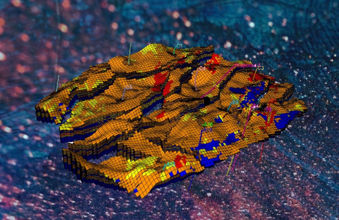
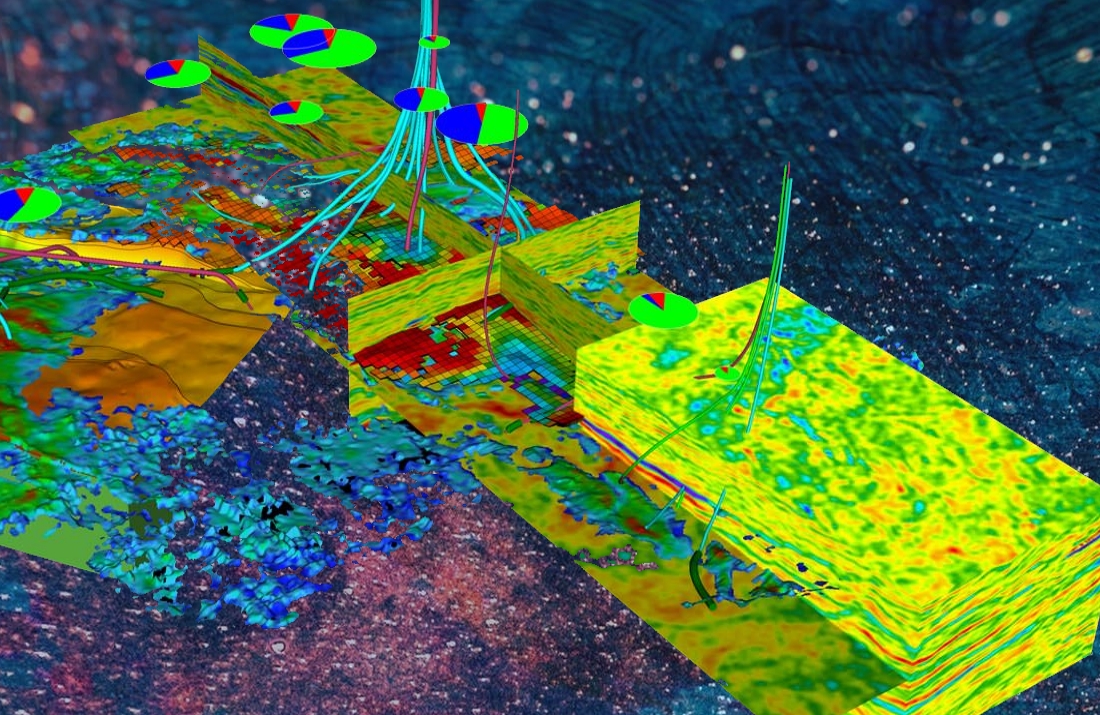
High-resolution visualization data, seismic volume interpretation and earth modeling from basin to reservoir scale to
provide valuable insights into the oil and water network reservoir, oil draining patterns through convergence of faults or
fractures to have a better understanding of trapping. It can also enable a detailed characterization of the potential
reservoir, enabling the successful exploration of reserves and identification of the best drilling targets.
This integral approach improves understanding of geologic mechanics, engineering and economic risks, enabling drilling
to begin with confidence. Better understanding enhances the ability to estimate reserves and determine investment
potential, facilitating the exploitation of your prospects –adding value to the decision making process.
Our International Presence
Services
Consulting
We help companies involved in several subsectors of the oil and gas industry, including: Conventional and unconventional oil and gas exploration and production.
Software
Software platform used in the exploration and production sector of the petroleum industry.
Reservoir Analysis
Geophysical and Geological Perspectives is a well-timed source of information addressing the growing integration of geophysical, geological, reservoir engineering, production, and petrophysical data in predicting and determining reservoir properties


 English
 Español
 -
-